Pages

Wednesday, May 21, 2014

Bahamas Year 3 Completed

Year #3 Bahamas Run completed...
WE DID IT! We launched our boat from the Island Packet Yachts Factory Refit program on November 4, 2013. We trucked it back to Snead Island Boat Works where we rebuilt all systems and re-installed the canvas, solar panels, mast, new rigging and all reworked wiring. On December 30, we sailed south from near Tampa Bay on the west coast, heading for Biscayne Bay on the east coast of Florida. We based in Biscayne Bay for two months and learned the beauty and diversity of the Bay from South Beach to Boca Chita to Coconut Grove to Key Biscayne. We sailed and enjoyed great anchorages and beautiful sunsets. On March 5th, we set sail for the Bahamas along with two new buddy boats, IP32 Morning Grace with Dixie and Julie and IP38 Moondance with Bob and Nina. Together we all three explored the Exumas south to Black Point, focusing on the Exumas Land and Sea Park. Moving north we sailed to Eleuthera and on to Abaco where we enjoyed relaxing for the month of April. In May, we blasted for home, running offshore legs from Ft. Pierce, FL to Charleston, SC and then onto the Outer Banks of North Carolina. From there we traveled the ICW north to the Chesapeake Bay to our home dock in Rock Hall, MD.

This is our SPOT Trip map, Click to Enlarge
https://spotwalla.com/tripViewer.php?id=880352c229a6c9074
We traveled 2,100+ nautical miles in five months. We had a slip in Bimini for 3 days and a dock in Charleston for 4 days, otherwise we lived on anchor or an occasional mooring ball and loved it. It was another wonderful season cruising and reviewing the Bahamas and learning Biscayne Bay. We will now take a one month break, to work on the boat and visit family and friends.

Our next voyage will begin on June 26th when we depart Rock Hall for New England.

Thank you for sailing along, it was a great trip!


Here are some HOME Photos....
Mooring Ball #50, Spa Creek Bridge, these are our home waters

Good Boat Buddies and Friends: IP40 TINTEAN
Sara and Ken invited us for a BBQ Steak dinner!

An Annapolis MD tradition, Chick & Ruth's Delly
Of course we went out for breakfast!

The Chesapeake Bay Bridge north of Annapolis, MD....HOME

Spring Cove Marina, Rock Hall, MD is our home dock

This is the place where we built our cruising dreams, we love it here

The loop is closed....time to run home for a quick break
Please take a look at our SPOT map here:
https://spotwalla.com/tripViewer.php?id=880352c229a6c9074
This map allows you to zoom in and see the beautiful islands, beaches and locations where we sailed. Spotwalla.com picks up where the SPOT company dropped the ball by not allowing users to easily save their pins.

Friday, May 16, 2014

Va to MD 22 hours

Blasting up the Chesapeake Bay in 22 hours....
We decided to make an overnight run from Portsmouth, Virginia, to Annapolis, Maryland, due to an approaching front and torrential rains. We also decided to make this run because a full moon was rising 3 minutes after sunset and the winds were to be 10-15 knots for a lovely broad reach. So, we departed the South Ferry Basin at 0800 hours, only to find ourselves in pea soup thick fog. There was so much fog that we almost could not find our way out of the Elizabeth River and into the Chesapeake Bay. By the time we reached Hampton and Point Comfort, we were considering diverting and dropping a hook to wait for the fog to lift. But after studying the weather we saw this fog would lift and be clear by mid morning. WRONG....WRONG...WRONG! This fog was with us for the next 22 hours. At times, we could not see more than 1/4 mile. We have sailed in Maine for three summers, so we have run in fog before, but we have never run in fog like this on the Chesapeake Bay!

This is your nighttime view from the helm
We said good-bye to IP38 Moondance, who headed to Deltaville, and we pressed on with IP40 Tintean. At night we had nearly zero visibility with zero horizon and no full moon could be found. We thought the full moon might light up the fog, but even when 1/4 mile off Cove Point Light house, we could NOT see the beaming light, so we knew the fog was still thick and dense. We pressed on at full speed, 6-7 knots and navigated our way north. Our radar and our AIS (Automated Identification System) alerted us to ships and their paths. We stayed out of the shipping lanes and in the 30-40 foot deep water where ships cannot run. All we could was watch the radar at a 3 to 6 mile screen and look for anything solid on our course.
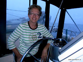
Radeen with little sleep and very tired
We looked for bell buoys, day marks, fishing boats and 1,000' long container ships doing 20 knots. We convinced ourselves that we were safe and that we would not hit anything and we kept moving. It was very stressful, especially for 22 hours with little sleep. At the end of this leg, we navigated ourselves into the Annapolis harbor with almost zero visibility. We could not see the Navy Fields or stone walls. We could barely see the first row of mooring balls, so we simply stayed along the port side and hugged the docks as we crawled toward the Spa Creek Bridge.

The Spa Creek Bridge at 6 am in fog


We passed under the bridge at 0600 hours and secured our favorite mooring ball #50 and crashed for a few hours! Later that day, we met good friends Ken and Sara of IP-40 Tintean, with whom we had traveled overnight from Virginia. They invited us to the Eastport Yacht Club for cocktails and snacks with friends. Then we moved on to Backyard Boats where we enjoyed happy hour snacks, more drinks and some dancing. It is great to be back in these waters and Annapolis. Thank you, Sara and Ken, for a great evening of celebrating our safe arrival!

One more leg and we will call this trip a wrap. Saturday morning we will sail the final leg to Rock Hall, MD where we will see friends and dock at our home marina, Spring Cove Marina. It is great to travel, but it is also wonderful to be in our home waters once again!

How to lift a Navy Ship and paint the bottom!

Imagine being stationed on a LIGHT SHIP. These were lighthouses anchored at sea
with 8-15 crew members, anchored year round off the coast!

With IP38 Moondance, the South Ferry basin where we love to dock 

IP40 TINTEAN with Sara and Ken and crew Trish the day before running the fog together

Portsmouth South Ferry Basin with our sun shades up.
It was 93 degrees and sunny! Notice the high tide goes over the dock

Morning fog as we depart Norfolk, VA

  Navy ships looking ghostly in the fog

This was our best visibility of the day

This was our radar view from 2000 to 0600, all night long

The Eastport Yacht Club new deck and view out to the Bay

Radeen and Sara enjoying the Eastport Yacht Club. Thank you, Ken and Sara!
One last leg home to Rock Hall, MD and this Bahamas Year #3 will be completed. What a great year it has been. Thank you for sailing along.

Tuesday, May 13, 2014

Dismal to Portsmouth VA

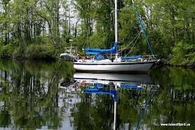
IP38 Moondance rounds a tree lined bend....
Note to All: The Dismal Swamp is not dismal, matter of fact, we find it interesting, beautiful, peaceful and photogenic!

After locking up 8-9 feet at the South Mills Lock, you run the 22 miles of the swamp canal where you enter the Deep Creek Lock and drop back down 8-9 feet. Exiting the Dismal Swamp northbound you are then presented with the massive commercial activity and Navy Ship Yards of Portsmouth and Norfolk, Virginia. We find this contrast most interesting, challenging and exciting. That is why we always stay a few days in Portsmouth, VA and enjoy the waterfront town, the Commodore Theater, and the peaceful historic streets and homes. Welcome home, you are almost back to the Chesapeake Bay!

Here are the photos of this section:
Hayden and Radeen at the Rose garden of Elizabeth City, NC

"Cappuccino Girl" Radeen enjoys breakfast out in Elizabeth City 

Tug-A-Long heads north for the Dismal Swamp


Tug-A-Long rounds a corner in the Pasquontank River

Buddy Boat IP38 Moondance heading north in the Pasquontank River

A turtle basking in the warm sun

Bob and Nina, IP38 Moondance in the South Mills Lock, entering the Dismal Swamp


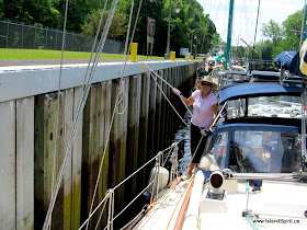
Locking up 8-9 feet at the South Mills Lock, entering the Dismal Swamp

Radeen the expert line handler in the South Mills Lock

Welcome to the Dismal Swamp Canal. Thank you ARMY CORP of ENGINEERS

Welcome to VIRGINIA, here is the state line sign in the swamp

I always LOVE this photo shot

The Deep Creek Lift Bridge

s/v ROMANO waiting for the lock to open

IP38 MOONDANCE waiting for the lock

IP38 MOONDANCE in our new anchorage at Deep Creek Basin

Deep Creek Basin is a great place to drop a hook

The Gilmerton Railroad Bridge lifting in front of the lowered Gilmerton highway bridge

Commercial Traffic everywhere in the river

FUNNY: A Lone Canada Geese wonders where he went wrong :-)

Tugboats moving an empty ship in the river as we pass by

My Favorite Sailor model, Radeen off the Navy Ship Yards
Our next leg will take us home into the wonderful Chesapeake Bay where we have sailed since 1984. This is when and where we feel at home, these are the waters we know, this is comfortable. We have traveled 1,917 nautical miles since December 30, 2013 from Tampa Bay via the Bahamas to the Chesapeake. We are glad to be here!

Saturday, May 10, 2014

Canals and Rivers NC

Buddy boat IP38 Moondance runs the canal...
This is our 5th passage through the waters of the Neuse River, Pamlico River, Alligator River and Pungo River and we never seem to get tired of taking in the diverse scenery and wild nature of this beautiful waterway. This trip was unusual in the fact that we could sail the entire area and some boats even ran a full jib, on a beam reach, while running the 22 nm Alligator River-Pungo River canal. From beautiful sunsets on anchor in the Alligator River to beam reaching across Albemarle Sound in 1-2 foot chop to a custom ultra light sea plane doing fly-bys and Marine Corps jets making practice flights, this leg is always so interesting.

IP38 Moondance Crossing Albamarle Sound
Along the canal we spotted many turtles and a few birds and one deer along the water's edge. When heading north, this leg ends in the CITY OF HOSPITALITY, Elizabeth City, NC where the famous ROSE BUDDIES host a free wine and cheese party for the visiting boaters. Former Mayor Steve Atkins and Charlotte Underwood, Director of the Convention and Visitors Bureau were our gracious hosts. There is no other town on the entire waterway that makes cruising boaters feel more welcome and more at home than Elizabeth City, North Carolina. Imagine giving away free docks and free water and free wine and free WiFi and free snacks just because we stopped in and visited. NO OTHER CITY does this! It is always a joy to spend time here and to support the local town by shopping, dining and spending money here. We will spend two days doing just that with our buddy boat friends Nina and Bob on IP38 Moondance. (Good-bye to new friends Dave and Suzy of IP37 Cay Paraiso who took the Virginia Cut route to Norfolk on their way home to Maine.)  Welcome to Elizabeth City, NC!

Here are some photos of this section

Alligator River-Pungo River Canal, 22 nm long
IP38 Moondance reaching across Albemarle Sound
R. E. Mayo Shrimp Dock and fishing fleet, Hobucken NC

Beautiful colors reflecting on the waterway

Jeff and Susan, of Active Captain website, passed us with their 53 footer named A Capella

It has been a VERY WINDY year. We needed to strike this flag, 1,875 nm so far

View from the helm while running the canal

Cypress tree stumps along the waters edge are so photogenic 

Sunset over the Alligator River after our first 90 degree day this year!

Alligator River Bascule Bridge, notice the flags blowing in nice 20 knots of beam winds

We got buzzed by a custom ultra light sea plane, how cool!

The pilot waved at us!

Our two day runs, about 50 miles each day

From Beautfort, NC we sailed north up the Neuse River to Bonner Bay where we anchored out. This map begins at Bonner Bay where we crossed Bay River and then motorsailed through the Alligator Pungo Canal and anchored in the Alligator River. From there, we sailed north on a nice west wind of 15-20 across Albemarle Sound and up the Pasquotank River to Elizabeth City.  We have had 3 days of great sailing - so much fun!

Here is our Spotwalla Trip Map
https://spotwalla.com/tripViewer.php?id=86e952b4252ab9f2e